May 2026

PRESIDENTIAL PRIVILEGE

Shawn MacMenamin,
LSPS President
Dear LSPS Members,
After another successful convention at the Golden Nugget, I would like to thank everyone who made it run so smoothly. Mrs. Liz Kearney and Mrs Hanna Broom worked tirelessly to ensure everything went off without a hitch.
I am incredibly grateful to our sponsors who came out to support LSPS, as well as our speakers and student volunteers who donated their time to make the convention a success. It is always wonderful to see old friends and meet new people entering the profession.
Looking ahead, we have one year left on our contract in Lake Charles and will be considering alternative sites for 2028.
Over the past few years on the executive board, we have realized just how politically inactive we were in the past. While we don’t want to become overly political, we must remain active to protect both our profession and the public. When we first hired a lobbyist a few years ago, I was skeptical. I didn't realize how much was happening behind the scenes that our group was completely unaware of. Now, thanks to her help, we are immediately informed of bills introduced in Baton Rouge that could affect surveying. Looking back, I wish we had been this active years ago when the trespassing law was changed.
In the past, we unsuccessfully tried to update the definition of survey in the revised statutes. We started the framework utilizing the NCEES Model Law and North Carolina’s law as our structure. Our efforts were steamrolled in the Senate Committee meeting. After we dusted ourselves off, we slowly got back to work, trying to make a game plan to push our definition through. The LSPS legislative committee, Derek Wheat, Brad Holleman, Elizabeth Harper (our lobbyist), and I have been meeting over the past few months to discuss our path forward. With the Supreme Court’s decision to uphold North Carolina’s updated survey definition, we will move forward with ours.
The LSPS Board has decided to create a Political Action Committee (PAC). After our first attempt to update the definition of survey, it became evident that we needed to build as many political allies as possible. As a board, we also recognized the need to keep this going. We need to make sure we protect our profession and the public from future political climates. There are a few laws that have been passed recently for which we could have used allies in Baton Rouge. The PAC is still a work in progress, and we are planning a rollout this summer.
The legislative committee members would like to attend district meetings to continue discussing this over the summer. As always, I look forward to meeting new people and discussing the merits of the PAC.
Please contact me or your District Chairman with any ideas or questions you may have. Thank you for this honor and privilege.
Sincerely,
Shawn MacMenamin
(225)278-8227(C)
shawn@gulfsouthls.com
65th Annual LSPS Convention
Held at the Golden Nugget – Lake Charles, LA
April 15-17, 2026
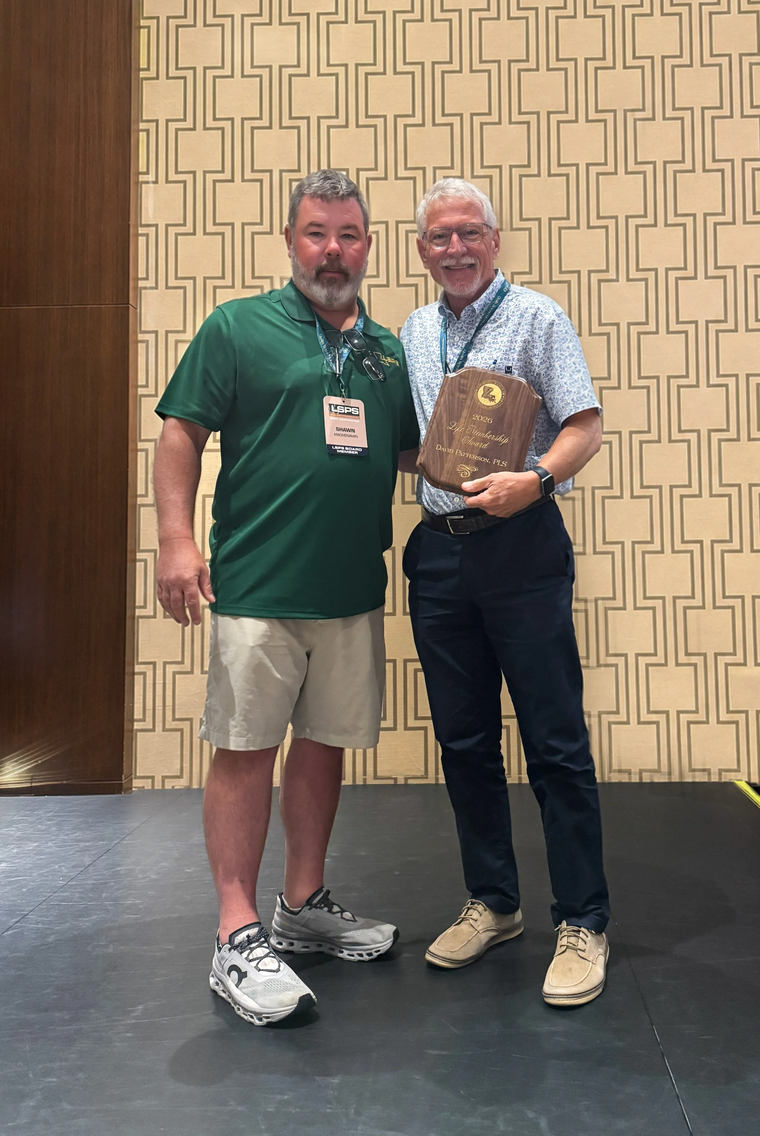
David Patterson, PLS was recognized with the LSPS Life Membership Award
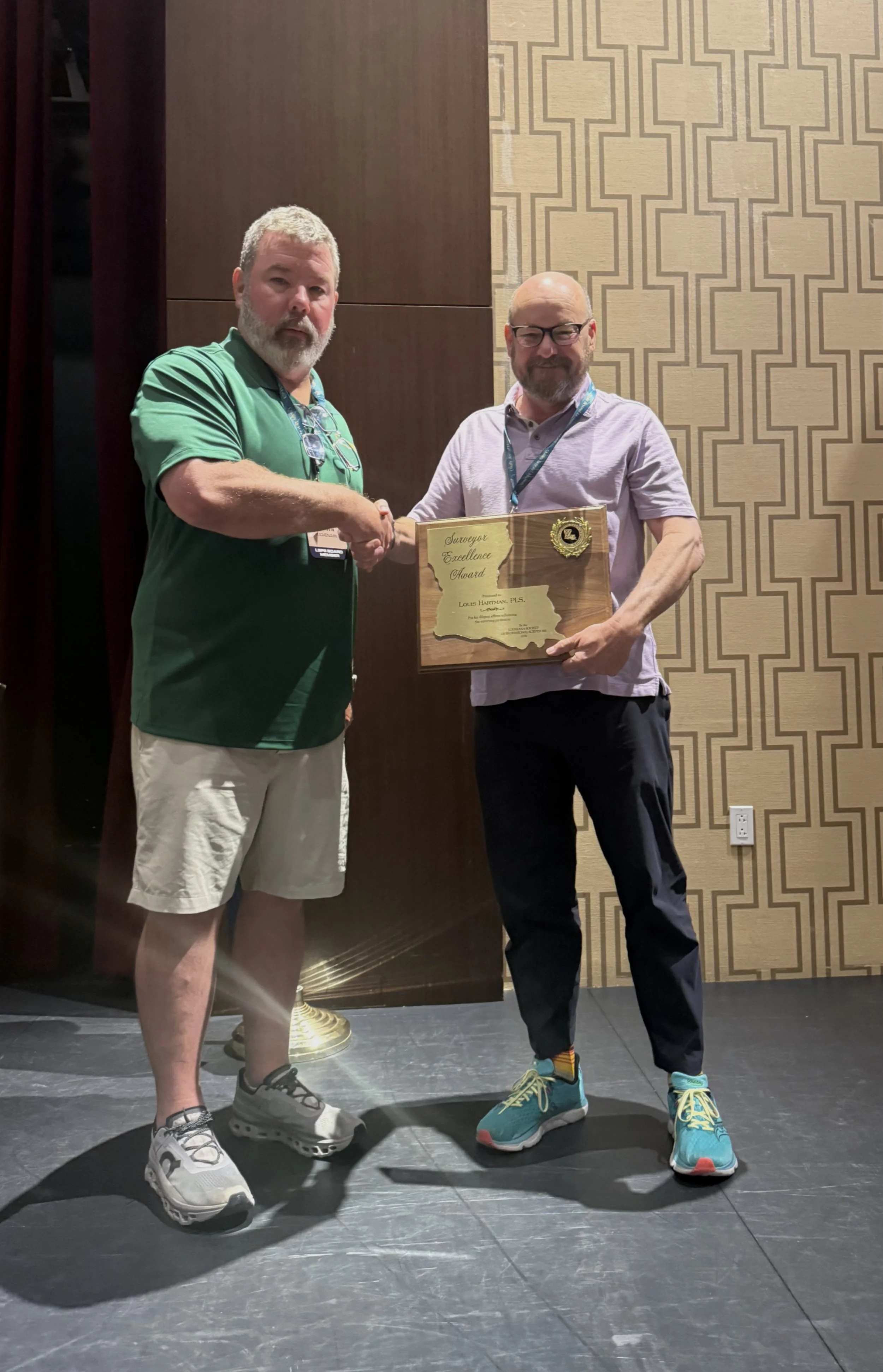
Louis Hartmann, PLS was recognized with the LSPS Surveyor Excellence Award
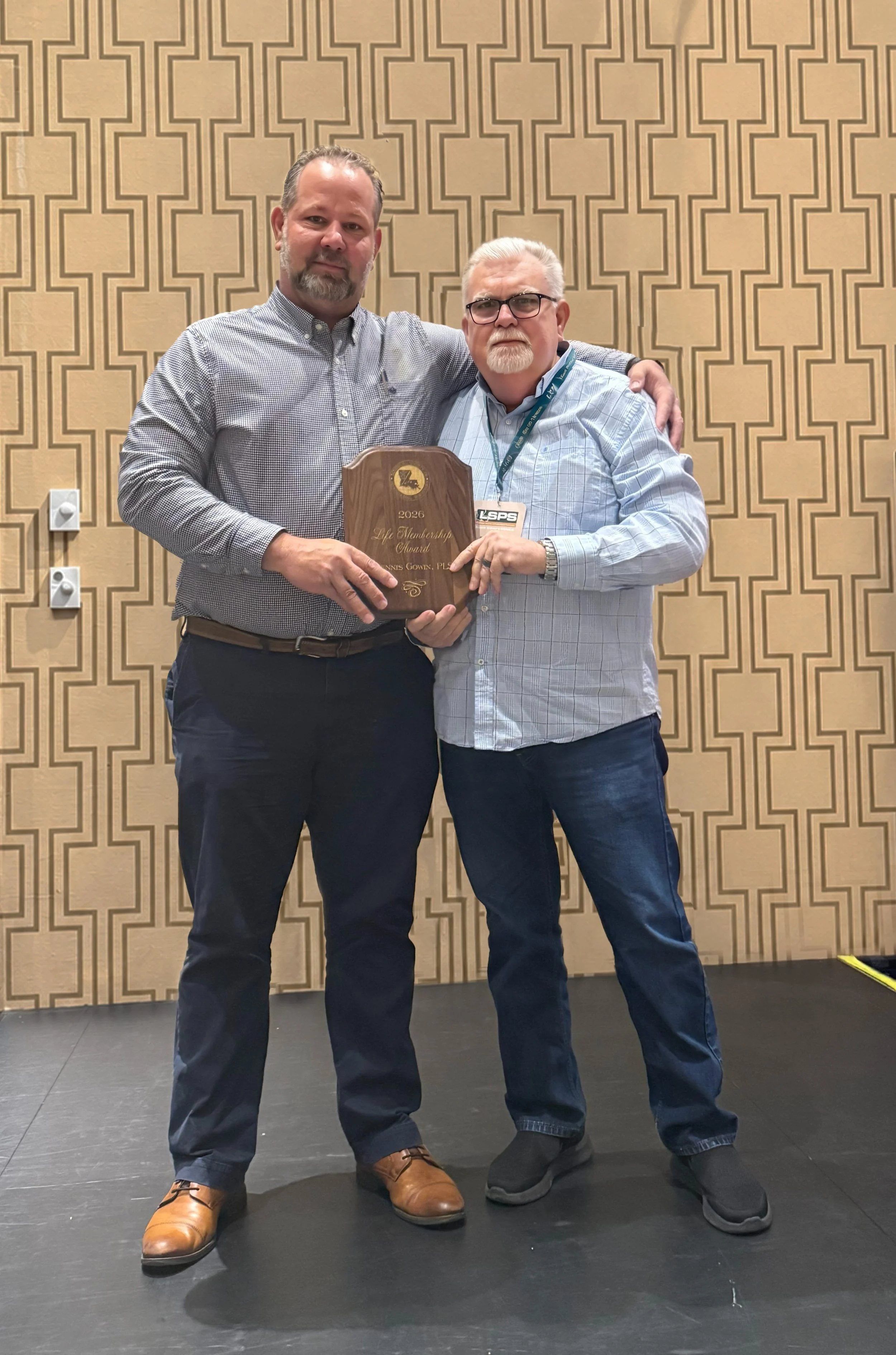
Dennis Gowin, PLS was recognized with the LSPS Life Membership Award
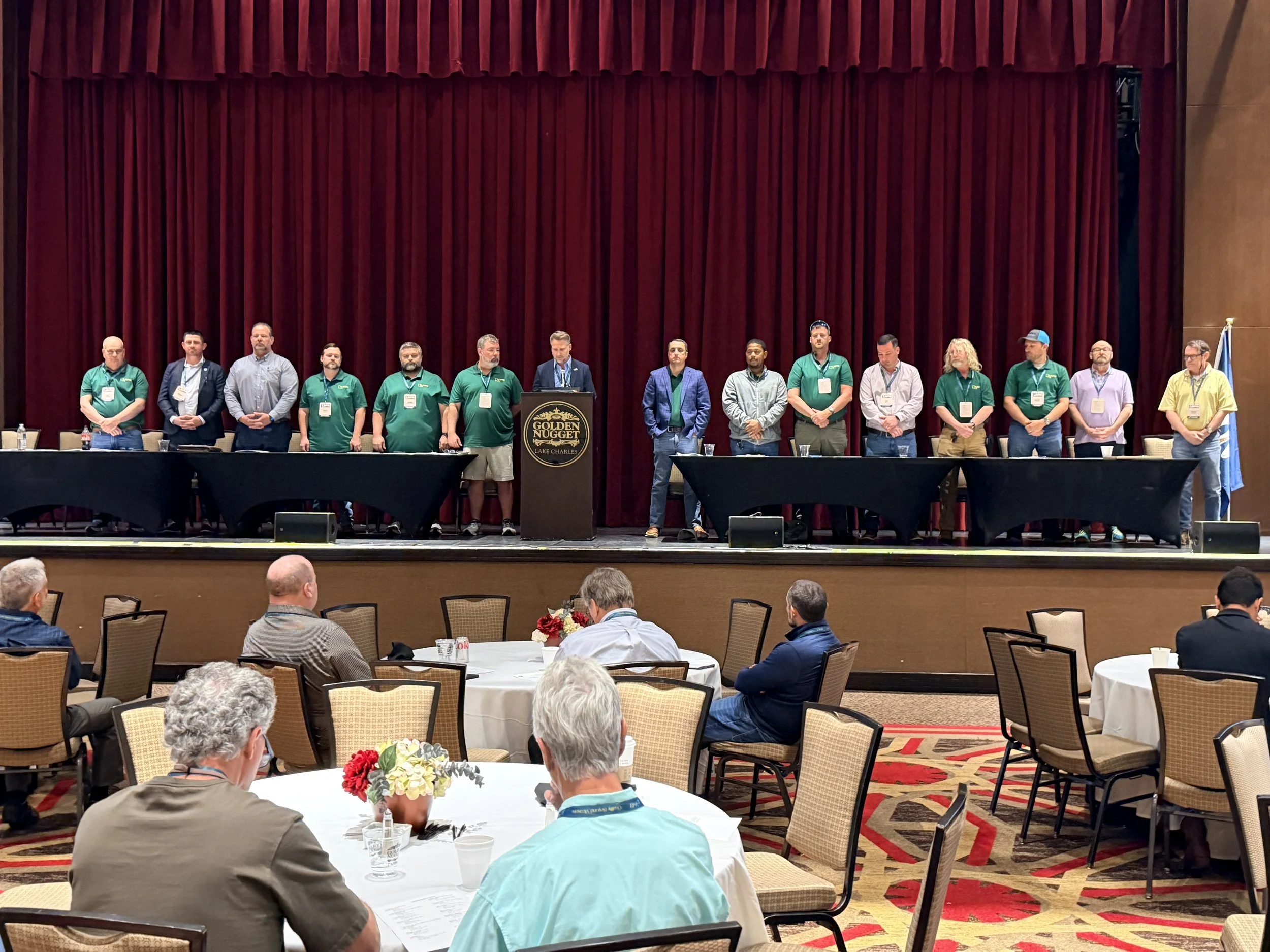
The 2026-2027 LSPS Board is sworn in by the NSPS Director, Brad Holleman, PLS, PE
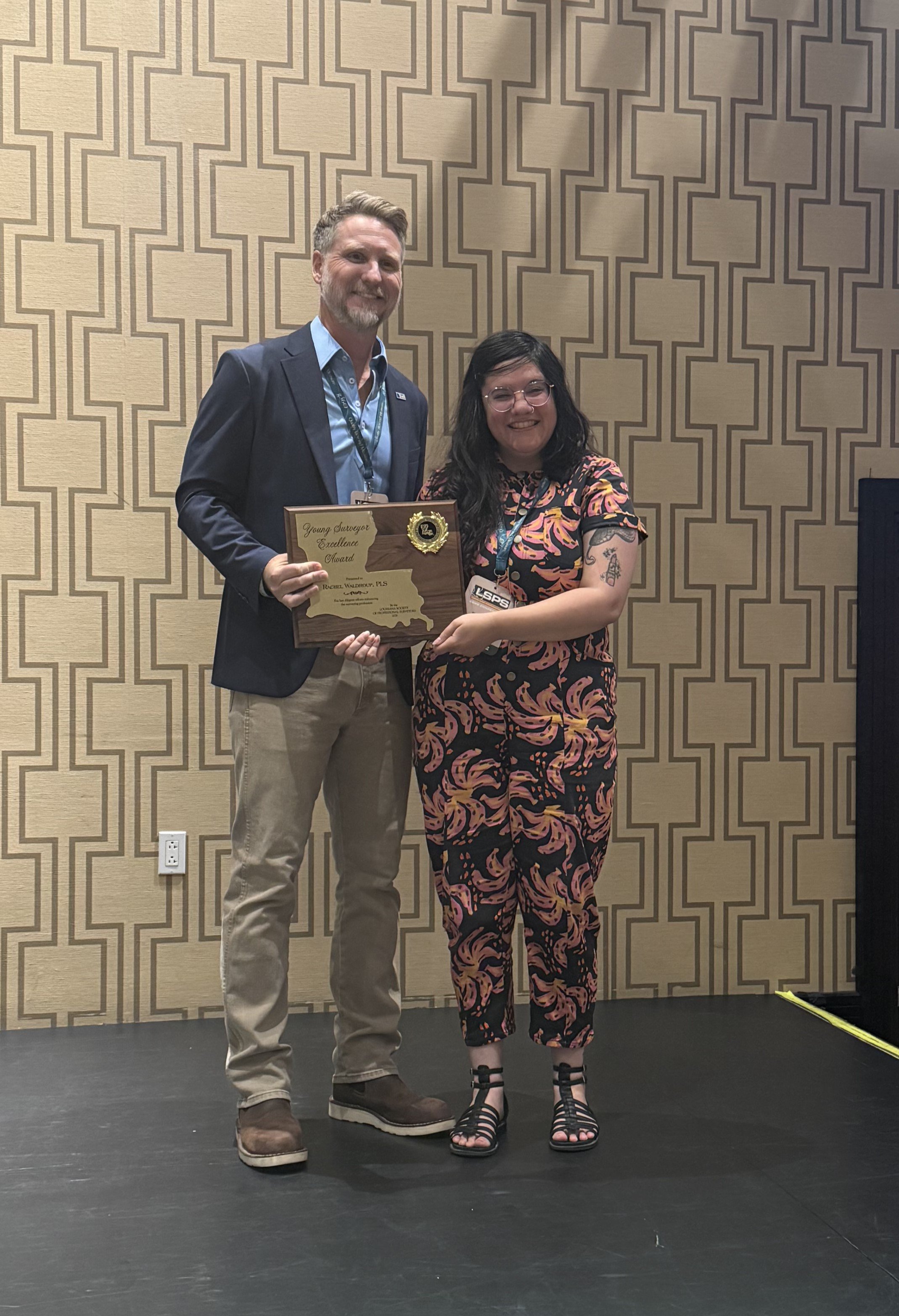
Rachel Waldroup, PLS was recognized with the LSPS Young Surveyor Excellence Award
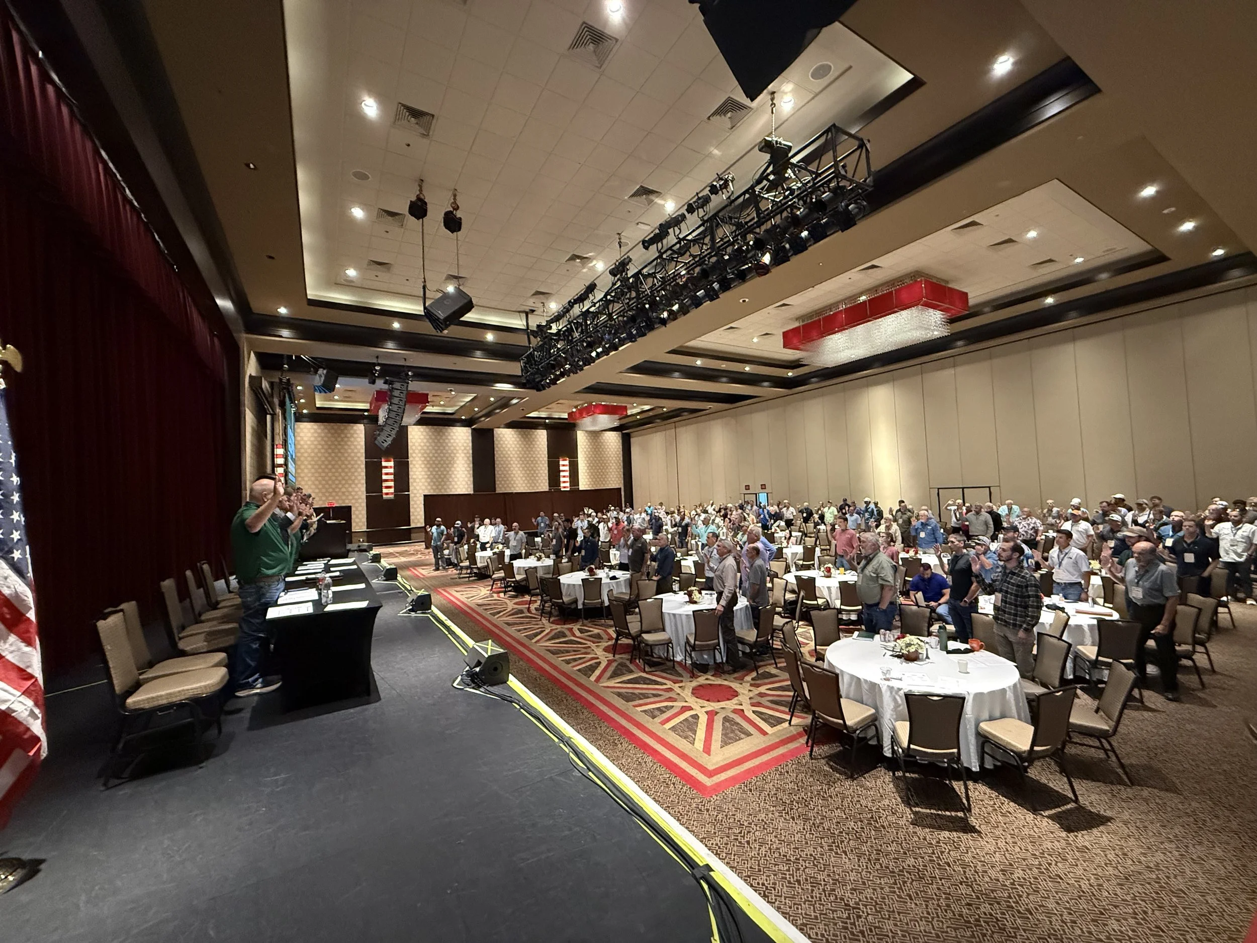
The LSPS Membership joins in the swearing-in of the 2026-2027 LSPS Board of Directors.
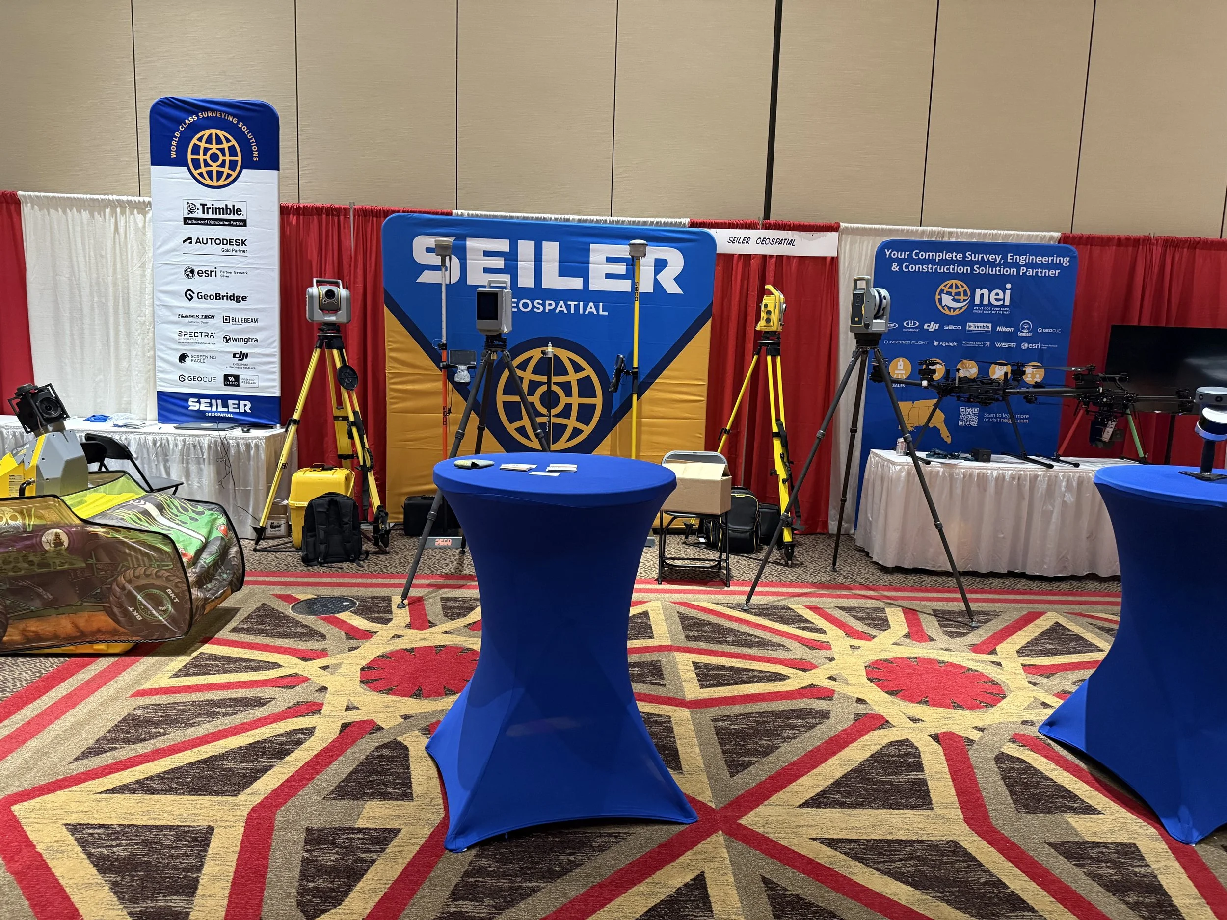
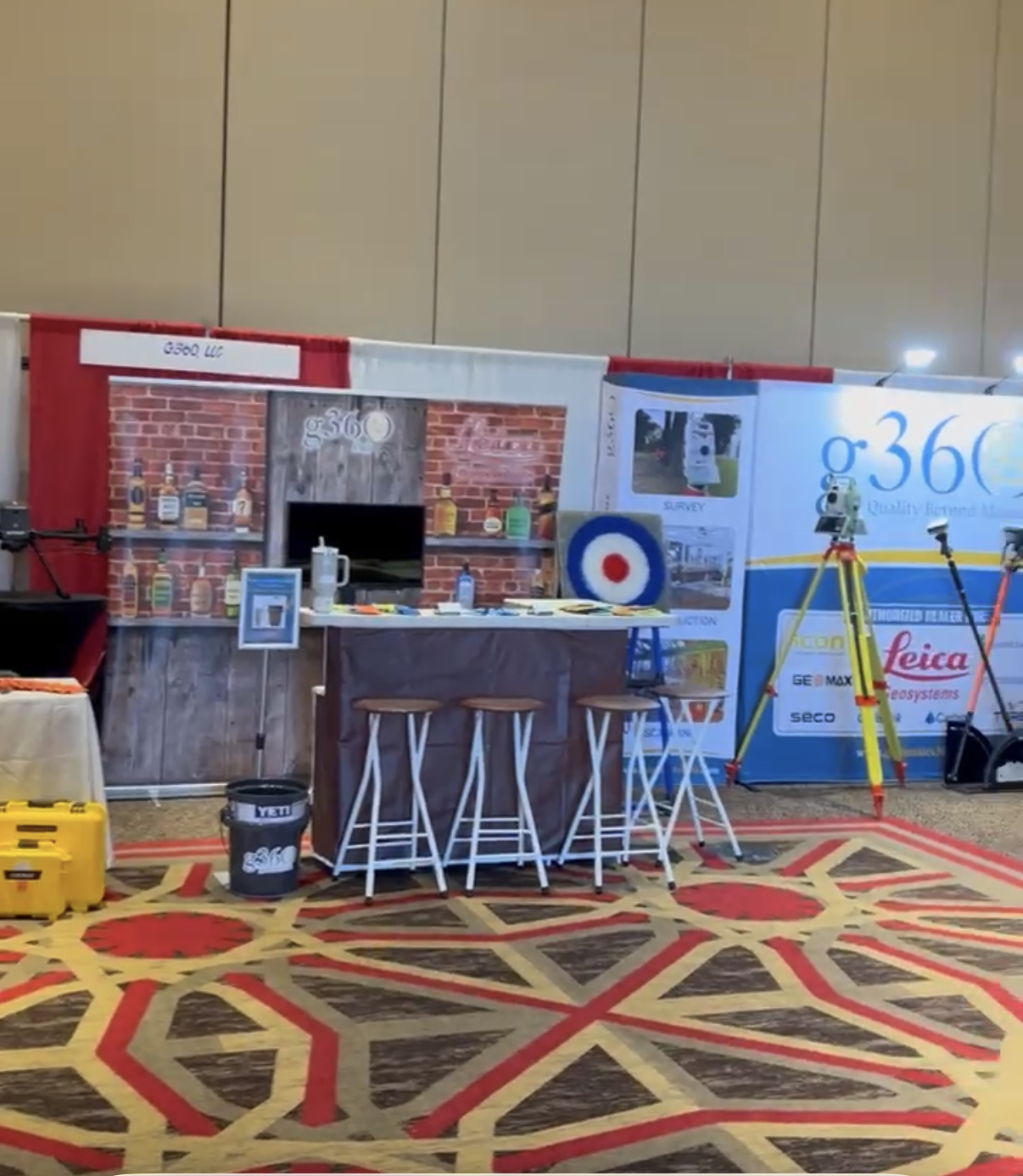
Many thanks to our Gold Sponsors: g360 and Seiler Geospatial/NEI
Advocating for the Profession: LSPS Representation in Washington, D.C.
By Brad Holleman, PLS, PE
Louisiana Director, NSPS Board of Directors
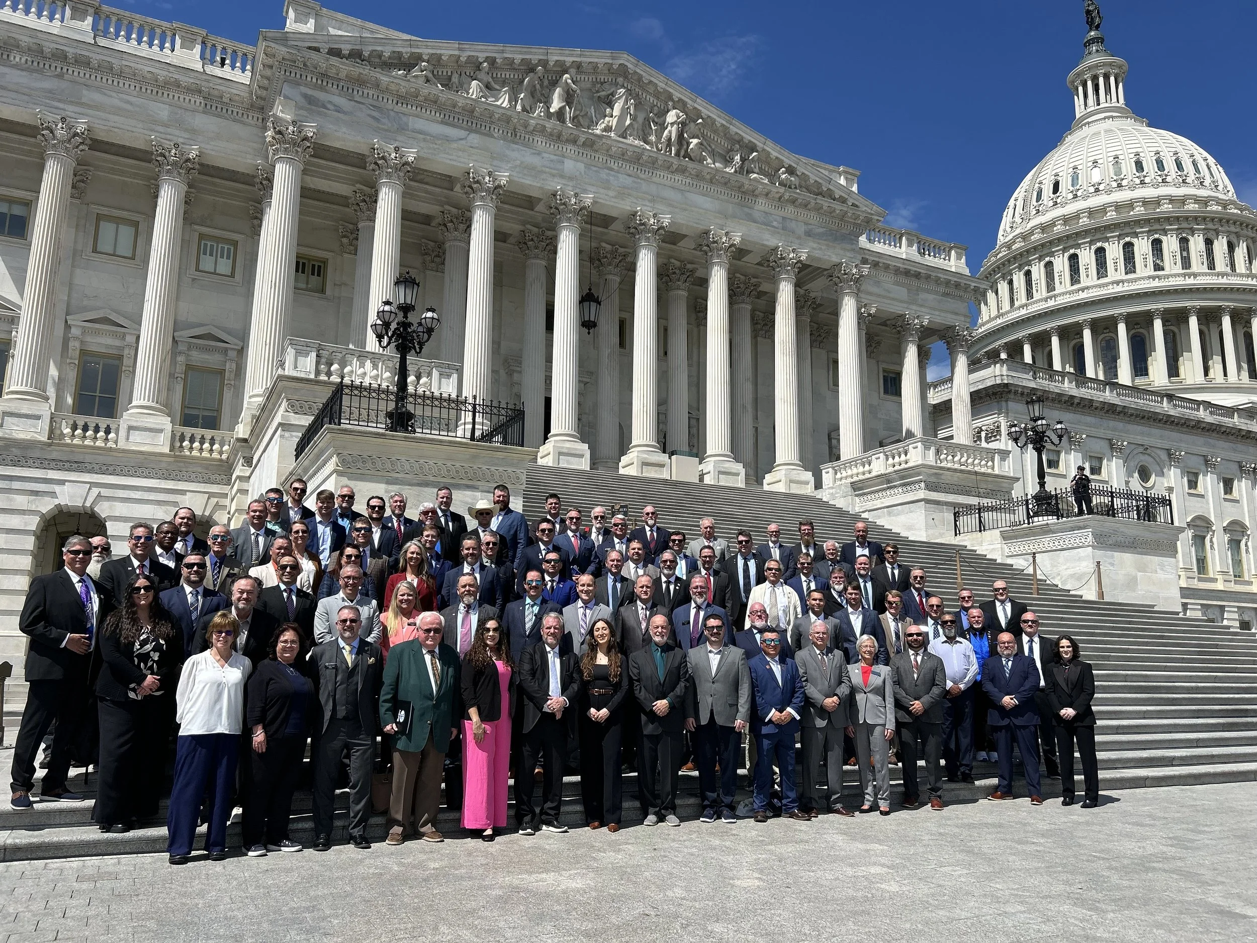
In April, I had the opportunity to represent the Louisiana Society of Professional Surveyors (LSPS) in Washington, D.C. during the National Society of Professional Surveyors (NSPS) Day on the Hill. This annual event brings surveyors from across the country together to advocate for our profession at the federal level—an effort that is becoming increasingly important as our industry faces evolving technical, workforce, and regulatory challenges.
Over the course of a single day — April 14 — I met with staff from the offices of Representative Julie Letlow and Senators John Kennedy and Bill Cassidy to make the case for legislation that would benefit our profession and our state. Here is a summary of what we asked for and why it matters.
HD MAPPING & GEODESY IN THE 2026 HIGHWAY BILL
The foundation of any accurate survey begins with a reliable geodetic framework. NSPS has been working to ensure that High-Definition (HD) Mapping and modernized geodesy infrastructure are included in the 2026 Federal Highway Bill reauthorization.
The National Geodetic Survey (NGS) is in the process of releasing a new national datum — NSRS 2022 — that will replace the aging NAD83 and NAVD88 reference systems currently in use. This transition will affect every surveyor in Louisiana who ties to national control, every infrastructure project that relies on elevation data, and every coastal or floodplain project where a few centimeters of vertical accuracy can mean the difference between regulatory compliance and costly redesign.
Securing dedicated highway bill funding for HD mapping and geodetic infrastructure ensures that local agencies have access to the most accurate positioning data available — keeping Louisiana's transportation network competitive, safe, and properly documented.
TAP PILOT PROVISION IN THE 2027 NATIONAL DEFENSE AUTHORIZATION ACT
Louisiana is home to several significant military installations — Fort Polk (Fort Johnson), Barksdale AFB, NAS JRB New Orleans, and Camp Beauregard — each producing separating service members with highly transferable technical skills in geospatial operations, engineering, and surveying-adjacent military occupational specialties (MOS).
NSPS is advocating for a pilot provision within the 2027 National Defense Authorization Act (NDAA) that would direct the Department of War's Transition Assistance Program (TAP) to connect separating service members with geospatial and surveying career pathways. Surveyors across Louisiana and the nation are experiencing a persistent workforce shortage. Veterans who have operated GPS equipment, performed field data collection, or managed geospatial information systems in the military are uniquely positioned to fill that gap — they simply need a structured bridge into the civilian profession.
I presented this ask to the offices of Rep. Julie Letlow (House Appropriations Committee) and Sen. John Kennedy (Senate Appropriations Committee), both of whom have jurisdiction over the report language that could make this pilot program a reality. Louisiana's congressional delegation understands military workforce issues — and this is an opportunity to connect two Louisiana priorities: veteran transition support and professional workforce development.
THE ALPHA-GAL ALLERGEN INCLUSION ACT (H.R. 1178)
This may be the legislative issue least expected in a surveying newsletter — but for those of us who spend significant time in the field across Louisiana's wooded and rural terrain, it is deeply personal.
Alpha-gal syndrome is a tick-transmitted allergy to mammalian meat and dairy products — triggered by the bite of a lone star tick. Unlike traditional food allergies, alpha-gal is not currently recognized as a major food allergen under the Federal Food, Drug, and Cosmetic Act, which means that packaged foods containing mammal-derived ingredients are not required to carry allergen warnings for alpha-gal sufferers.
H.R. 1178, the Alpha-Gal Allergen Inclusion Act, sponsored by Rep. Jeff Van Drew (R-NJ) with 36 bipartisan cosponsors, would change that. It would codify alpha-gal as a major food allergen and require plain-language labeling of mammal-derived ingredients on packaged foods sold in the United States.
I met with the office of Sen. Bill Cassidy to urge his support for a Senate companion bill. Sen. Cassidy, a physician by training, is well positioned to understand the medical significance of this condition and the impact that proper labeling can have on the quality of life of those affected. NSPS voted to support an Alpha-Gal Awareness Resolution at our Fall 2025 meeting, and Louisiana's voice in this conversation matters.
Why It Matters
Advocacy efforts like Day on the Hill are essential to ensuring that the surveying profession remains visible and relevant at the national level. Many of the decisions made in Washington have long-term implications for how we practice, from geodetic standards to workforce pipelines.
As surveyors, we are often behind the scenes—but our work forms the foundation of infrastructure, land ownership, and development across the country. It is important that policymakers understand that role and the value we provide.
LOOKING AHEAD: JOIN ME ON THE HILL IN 2027
One of the most encouraging things I observed during this year's legislative visit was the strength in numbers that other states brought to the table. Several states had multiple representatives present — surveyors and geospatial professionals walking the halls of Congress side by side, reinforcing their message with every additional handshake and conversation. It made an impression, and it made a difference.
Louisiana deserves that same presence.
NSPS's Day on the Hill is scheduled again for spring 2027, and I am personally inviting any LSPS member who is interested in attending to join me. You do not need to be a policy expert or a lobbyist — you simply need to care about this profession and be willing to show up. NSPS prepares participants thoroughly: the legislative priorities are clearly defined, talking points are provided, and meetings are coordinated in advance. Your job is to show up as a Louisiana surveyor and tell your story.
Think about what that looks like: a Louisiana delegation walking into congressional offices together, representing not just a national organization but the surveyors and geospatial professionals doing real work right here in this state. That is how our profession gets noticed — and that is how we get things done.
If you are interested in attending Day on the Hill in spring 2027, please reach out to me directly. I would love nothing more than to have company on the next trip to Washington.

WE
NEED
YOUR
HELP!

We want to help worthy students join us in the Land Surveying profession!
Please donate to:
1.The Education Foundation grants scholarships while providing guidance by assisting worthy students to obtain instruction and training in land surveying and higher education.
2.The Every Member Campaign (EMC), which began in 2006, was created solely for the purpose of supporting the Geomatics Program at Nicholls State University.

Donate to the Disaster Fund so that we can always stand ready to give relief when disaster hits our area.

Donate to the Legislative Fund so that we can be ready to address legislation affecting our Surveying Profession.
LSPS DISTRICT INFORMATION

District 1
Louie Hartman
louie@gkcsurveyors.com
District 2
Derek Martin
dmartin@apexsurveyllc.com
District 3
Devon Richard
devoncrichard@gmail.com
District 4
Matt Caraway
matt@raleyandassociates.com
District 5
Randy Denmon
randy@denmon.com
District 6
Derek Wheat
derek.wheat@yahoo.com
District 7
Garry Johnson
gjjengineering@yahoo.com
District 8
Matt Phillips
matt@lodestone.biz
District 9
Cory MacMenamin
cmacmenamin@ddgpc.com
If you are not an LSPS member, we would like to invite you to attend a District meeting in your area. Contact the LSPS office at lsps@lsps.net, or the chairman in your area noted above for details about upcoming meetings.
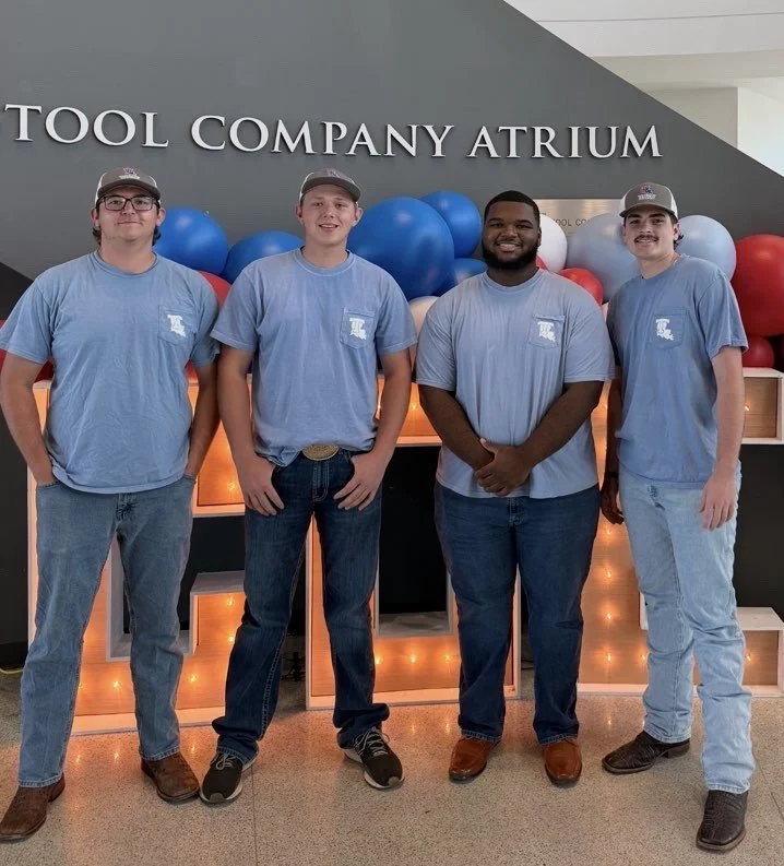
LOUISIANA TECH STUDENT CHAPTER UPDATE
May 2026
Eleven LSPS student chapter members attended the LSPS convention in Lake Charles, April 15 - 17.
All of the students enjoyed networking with the LSPS attendees and the knowledge gained.
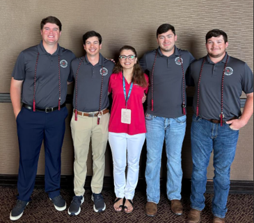
The student chapter recently held elections for officers for the 2026-2027 academic year.
Pictured (from l to r) Waylon Miller - Treasurer, Colby Creamer - President, Jeremiah Gray - Vice-President and Lathan Whiddon - Secretary.
BE a SURVEYOR .COM

Revamped and Ready to Educate: beasurveyor.com
Beasurveyor.com has undergone a complete redesign, tailored specifically to engage K-12 audiences. With a sleek new design and user-friendly interface, the website is geared towards making surveying accessible and exciting for young minds. The updated aesthetics, curated videos, and intuitive navigation are sure to captivate students and educators alike.
Surveying Outreach Resource Page
One of the standout features of the redesigned website is the Surveying Outreach Resource Page. This section is a treasure trove for surveyors interested in outreach and educators looking to incorporate surveying into their curriculum. It offers a variety of valuable resources. You can download lesson plans for classroom activities, access surveying presentations, play videos, and even order materials for speaking engagements or career fairs.
For those new to outreach, the "Outreach 101" section offers guidance on how to effectively engage students and the broader community in surveying. It's the perfect starting point for surveyors eager to share their knowledge.
Why Focus on K-12 Education?
The decision to cater to K-12 audiences is a strategic move. After a yearlong research project, results pushed for outreach efforts to be aimed mainly at K-12 demographics. By introducing surveying to students at an early age, beasurveyor.com aims to kindle an interest that could turn into a lifelong passion and a career choice. Although K-12 is the main target audience, the website and outreach plan will incorporate college students, ex-military, and others looking for a change in career.
Get Started Today
Together, we can inspire the next generation of surveyors and change the way they perceive the world around them. Visit the new and improved beasurveyor.com today and be a part of the surveying revolution!
NICHOLLS GEOMATICS PROGRAM UPDATE
May 2026
By: Dr. Esra Tekdal-Yilmaz
Greetings from the Nicholls Geomatics Program.
As the semester and academic year comes to a close, we want to share some exciting updates, celebrate our students' incredible achievements, and express our deep gratitude for the community that supports us.
Industry Engagement & Service-Learning
As part of our GEOM 104 Service-Learning course, we recently hosted Mr. Carlos Femmer from HDR Engineering, alongside Ms. Donna Sentell and Ms. Shanna Hubble from LAPELS. We sincerely thank them for engaging with our students and dedicating time to support their professional development.
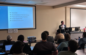
Mr. Carlos Femmer giving a presentation.
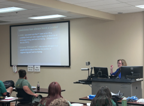
Ms. Donna Sentell giving a presentation.
Hosting the 2026 ASPRS Gulf South Region Conference
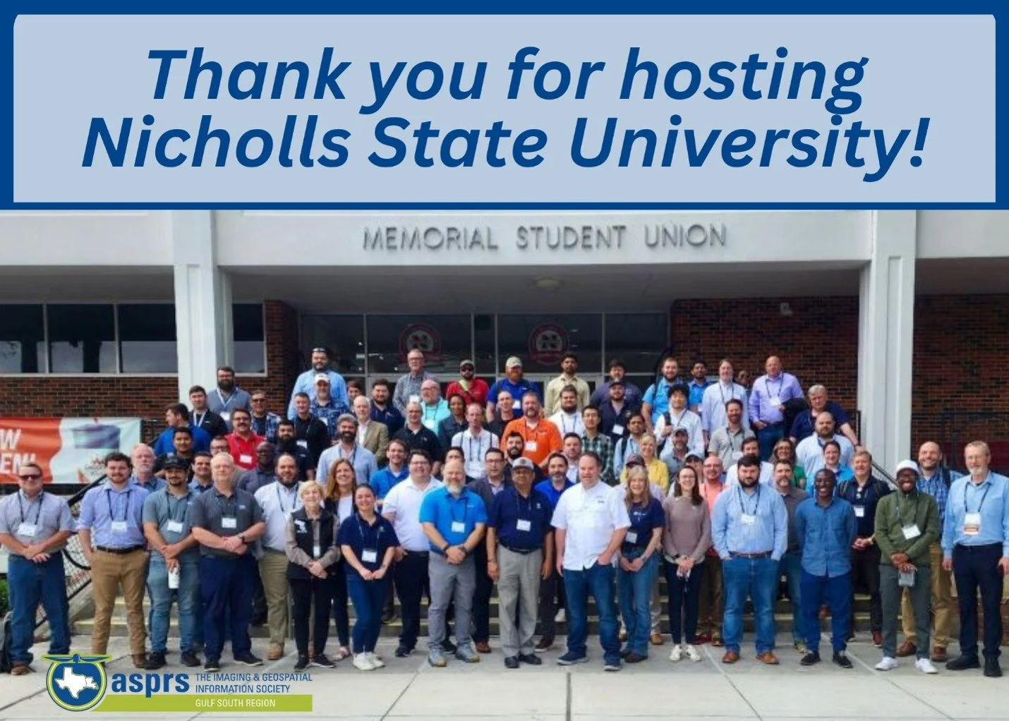
The Nicholls Geomatics Program successfully hosted the 2026 ASPRS Gulf South Region Geospatial Conference from April 8–10, 2026, right here at Nicholls State University. This in-person event featured:
Geospatial technical sessions and a 4-hour Preparation for ASPRS Certification Workshop.
A Geospatial Experts Panel moderated by Kent Groh of The Geoholics.
Sponsor equipment demonstrations.
Graduate student oral presentations and an Undergraduate Student Poster Competition.
A special congratulations to Mr. Samuel Landry, who presented at the conference and took first place in the Undergraduate Poster Competition, earning a certificate and a cash prize of $750!
Student & Faculty Achievements
National Lightning Talk: Mr. Samuel Landry, Undergraduate Research Assistant to Dr. Balaji Ramachandran, was invited to give a lightning talk at the virtual 2026 Esri Imagery & Remote Sensing Education Summit (April 22–23, 2026). His presentation was titled, “Utilizing GeoAI for Rapid and Accurate Damage Assessment.”
NSF Workshop Selection:Dr. Balaji Ramachandran was selected to attend the 2026 National Science Foundation NHERI RAPID 4-Day Workshop at the University of Washington in Seattle from July 21–24, 2026.
National Judging & Program Promotion:Dr. John Dennis will serve as a judge at the upcoming ASCE-UESI National Surveying Competition at Fairmont State University in West Virginia. He will also be working hard this summer to promote our program through the Geomatics Flight Plan.
Scholarship Winners: Congratulations to geomatics students Jayden Leblanc and Holden Tabor for being awarded scholarships from the Red River Desk and Derrick Club in Shreveport. We are incredibly grateful for the club's investment in our students as they expand their reach into broader engineering fields.
Licensing Milestones
Four of our seniors, Jake Chauvin, Brennan Hamner, Noah Morris, and Reece Toups, passed their Fundamentals of Surveying (FS) exam! They were awarded the prestigious NCEES Graduation Honor Cord. As always, we are incredibly proud of their hard work and dedication.
From left to right: Brennan Hamner, Jake Chauvin, Dr. Esra Tekdal Yilmaz, Reece Toups, and Noah Morris.
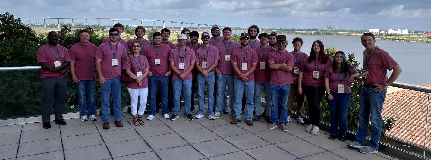
Nicholls State Geomatics faculty and student attended LSPS Convention.
LSPS Convention Attendance
Faculty members Dr. Esra Tekdal Yilmaz, Dr. Patrick Ogao, and Dr. John Dennis attended the LSPS Convention in Lake Charles along with 21 of our geomatics students. We would like to extend a huge thank you to everyone whose generous donations helped fund the hotel rooms for our students to attend this valuable networking event.
Celebrating the Class of 2026
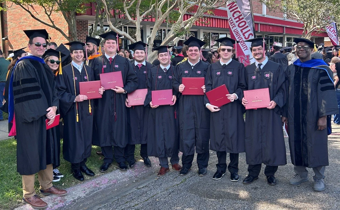
We brought the academic year to a close with a wonderful graduation ceremony on May 16th. Seven of our exceptional geomatics students walked across the stage to receive their diplomas. We cannot wait to see where their careers take them next!
We want to extend a huge thank you to our Administrative Assistant, Donna Lamartina, as she officially retires! Donna has been the backbone of the Geomatics Program for years, keeping us organized and supporting our faculty and students. Please join us in thanking her for her incredible service and wishing her a very happy and well-deserved retirement.
As we wish you a wonderful summer, please look out for the ABET alumni and employer surveys that will be sent out soon, as we look forward to your contributions and deeply appreciate all that you do for our program.
LEGISLATIVE UPDATE May 2026
By: Harper Duncan & Associates, LLC
The Louisiana Legislature convened for the 2026 Regular Session on Monday, March 9, 2026, and must adjourn by Monday, June 1, 2026. Unlike last year’s fiscal session, this general session allows lawmakers to file bills on a wide range of policy issues. The session has been especially active on property rights, infrastructure, and expropriation.
More than 1,700 bills have been filed during the 2026 session, including a notable increase in measures addressing expropriation (eminent domain) and landowner protections. Many of these proposals reflect ongoing debate over carbon capture projects, pipeline development, foreign land ownership, and national security concerns involving infrastructure and military installations.
HB 7 & SB 60 - Louisiana Landowners Protection Act
House Bill 7 and Senate Bill 60 would prohibit private entities from using expropriation authority for carbon dioxide pipelines and carbon sequestration projects. The bills were introduced in response to landowner concerns about carbon capture infrastructure and the use of eminent domain for pipeline corridors.
Current status:
· HB 7 was involuntarily deferred in committee on March 31.
· SB 60 remains pending in Senate Natural Resources and has not been scheduled for a hearing.
HB 192 & SB 200 - Foreign Adversary Legislation
The measures gaining the most momentum this session focus on foreign adversaries and national security.
· HB 192 proposes a constitutional amendment barring foreign adversaries and their agents from expropriating property in Louisiana. The measure has passed the House and, if approved, would go before voters on the November 2026 ballot.
· SB 200 would authorize Louisiana to expropriate land near military installations if it is owned by foreign adversaries and considered a threat to public safety or national security. The bill continues to advance with broad legislative support.
Together, these bills reflect a broader national trend of increased scrutiny of foreign ownership of land and infrastructure, especially near military facilities and other critical corridors.
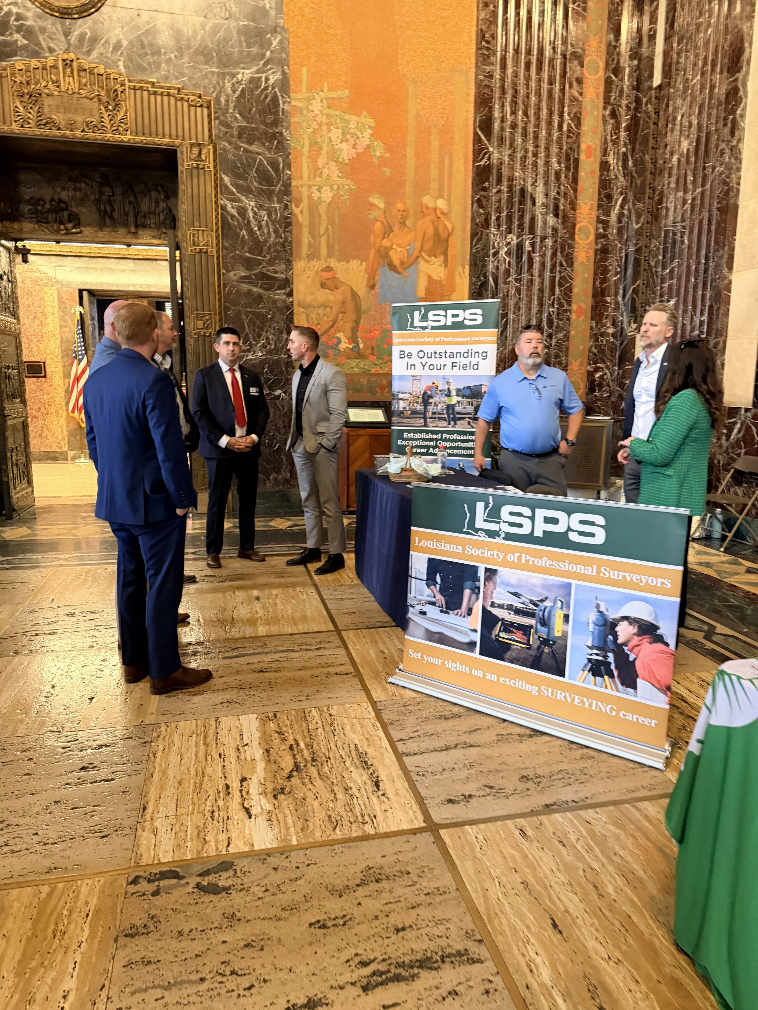
LSPS Day at the Capitol
LSPS members recently gathered at the Louisiana State Capitol for Surveyor Day at the Capitol, meeting with legislators and staff to discuss issues affecting the surveying profession and property rights in Louisiana.
Events like this help educate policymakers about the essential role surveyors play in infrastructure development, economic growth, emergency response, and the protection of property rights across Louisiana.
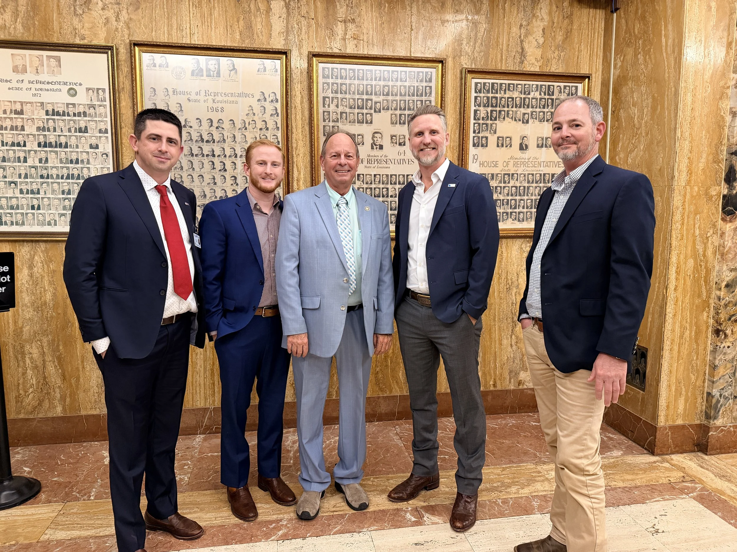
Derek Wheat PLS, Colby Mire PLS, Senator Gadberry, Brad Holleman PLS, Trent Iglehart
The Survey of ‘John’s Little Acre’
As Published in American Congress on Surveying and Mapping Bulletin, August 1975, page 7
Originally Submitted by
L. M. Powell, Land Surveyor Hamilton, Montana
Submitted to LSPS by Jerry Middleton
In the beginning, God created Heaven and Earth---and the Great Flood and the Ice Age passed, and there were stones and soil and minerals on John’s little acre.
In 2500 B.C., by a strange mutation, surveyors were created, and their work became a profession. At the time, doctors were still rattling bones and chanting to cure their patients, and lawyers were meting out justice on the “eye for an eye, tooth for a tooth” principle. And each spring, the Nile destroyed the survey markers, and they had to be remeasured so taxes could be levied, and trees grew on John’s little acre.
Years passed, and in England, the Common Law was established, and it was good- it was horse sense. To fulfill the claim of land ownership, metes and bounds descriptions were prepared, such as,
“Beginning on the bridge across Spring Creek at the west edge of the town of Devonshire, England, thence north along the center of Spring Creek to the stone fence along Jones’s south line, thence west along said stone fence to a lone oak tree.”
And once each year, the people of the village walked the property lines, and each owner performed a ritual that laid claim to his land and grew on John’s little acre.
The compass was invented, the world became round, sailors navigated, America was discovered, the Mayflower sailed, and buffalo grazed on John’s little acre.
The Colonies were formed, and wars were fought; Washington and Lincoln were surveyors, and birds sang on John’s little acre.
In 1803, the Louisiana Purchase was made which placed a value of $0.04 on John’s little acre. The sectionalized system of land surveying had been in use for some time when the surveyor entered the Bitterroot Valley in 1872 and determined that Section 23, T 6 N – R 21 W, P. M. ‘M’ included John’s little acre.
And stones were set and witnessed every half mile around Section 23, and the Government said, “This is good and proper, and these markers shall govern the perimeter and the aliquot parts of Section 23 regardless of errors in the original measurements.”
And the SW¼ of Section 23 included John’s little acre.
In the year 1890, a homestead was patented to a man named Bill, which covered the SW ¼ of Section 23, and Bill thought he owned exactly 160 acres bounded by lines bearing due north, south, east, and west, but he didn’t; the acreage was short and the lines crooked, but it still included John’s little acre.
Now, John was a friend of Bill’s, so when he moved to the Bitterroot Valley in 1895, Bill deeded him an acre of land for his homesite. The two men agreed on the boundaries, paced the distances, and drove buggy axles on the four corners. They estimated that the SW corner was about 200 yards NE of the SW corner of Section 23, and a point of beginning was established for John’s little acre.
In 1898, John decided to get married and mortgaged his acre to acquire funds to improve the house. The bank required a survey of the property, so a man with a compass and chain was hired. Due to a deposit of iron ore near the SW corner of Section 23, his bearings were erratic, and since the area was brushy, his distances left something to be desired, but the buggy axles were there and still marked the true boundaries of John’s little acre.
By 1910, the orchard boom was on. The area had been cleared and planted with apple trees. The bearing trees had been cut, and the section corner stone covered with soil. An orchard development company had purchased Bill’s 160 acres and directed their surveyor to locate the exception, which was John’s little acre.
The surveyor, assuming that the section corner was lost, found the four buggy axles and, using the erroneous data from the previous survey, set a pipe to mark the SW corner of Section 23. Using a transit and steel tape, he retraced the angles and distances between the four buggy axles and prepared a new description (the third) for John’s little acre.
During the construction of a county road in 1920, the corner stone on the SW corner of Section 23 was found and reset beneath the road surface. In 1921, the four buggy axles were tied to the true section corner, and a new description (the fourth) was prepared for John’s little acre.
In 1960, a theodolite was used, and the bearing was corrected slightly on John’s little acre. In 1970, an electronic measuring device was used, and the distances were corrected slightly on John’s little acre.
And so it came to pass that by 1970, John’s little acre had undergone numerous descriptions, but it had, in fact, never changed. The true boundaries were still marked by four buggy axles, the bearings and distances bore little resemblance to the original deed, the acreage was actually 1.265 acres, but it was STILL John’s little acre.

JOIN LSPS:
The Louisiana Society of Professional Surveyors is organized to enhance the Surveying Profession. Our goal is to carry out our mission by maintaining high technical and cultural standards in our field, working with educational institutions for the maintenance of high standards of education in Land Surveying, requiring a high standard of ethical practice by our members, and encouraging the personal and professional development of young Land Surveyors.
WE’D LOVE TO FEATURE YOUR SURVEYING PICTURES IN OUR NEWSLETTER!
Click the link below to submit your photos.